

Putting my boots on in the car park of the Brotherswater Inn, my eyes are drawn upwards to the long straight grassy ridge that leads to the summit of Caudale Moor. Stretching high into the blue sky it gives the mountain the look of a giant green Lakeland pyramid and I wonder what ancient king is buried at its centre. This ridge is my chosen route to the heights today where I’ll be visiting Caudale Moor, (which has a somewhat split personality as it is also known as Stony Cove Pike and John Bell’s Banner) and Hartsop Dodd. The ridge looks pretty steep from the car park but I console myself with the words of Wainwright, who says “Of the many approaches to the summit, this is by far the best”.

And this indeed proves to be the case. The road and intake fields are soon left behind and the square blue stamp of Brothers Water seems to grow in size as I slowly gain a birds eye view of it. Cloud reflections move slowly across its surface waters like some giant screensaver on a monitor.

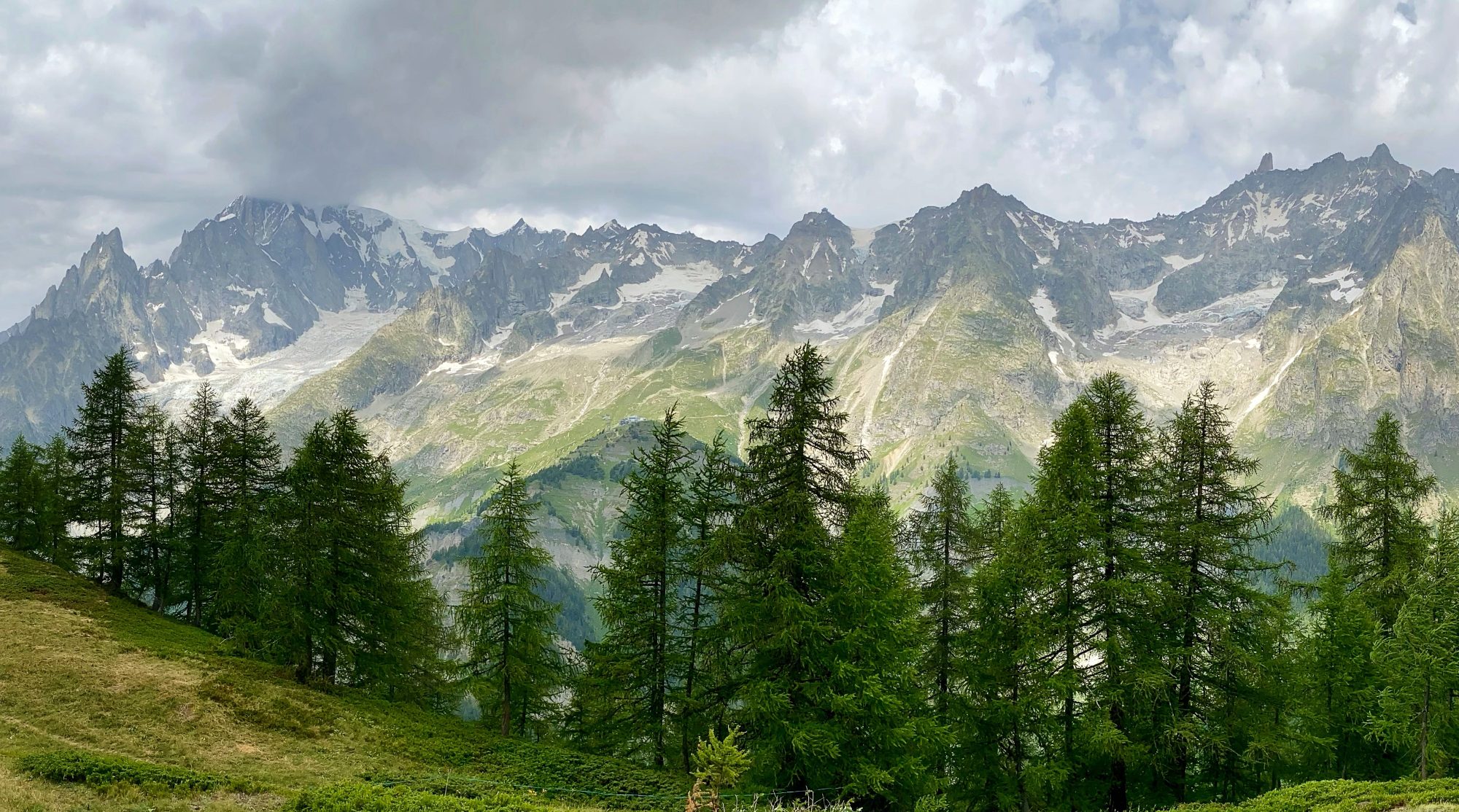
I pass above the old mine workings and Red Screes and Middle Dodd come into fine view across Kirkstone, the road winding down from the top of the pass like a tarmac stream. Across Caudale, Hartsop Dodd starts to shrink in size as I climb ever higher and eventually I am looking down on it.


It is a sustained, steep climb but a rhythm can be established and before long I am standing at the large cairn that marks the summit of Caudale Moor.

As already mentioned, Wainwright likes to confuse us by calling the mountain Caudale Moor but the summit Stony Cove Pike but there are distinct cairns for both. Take your pick as to which is higher as the Ordnance Survey, Harvey’s and Open Street Map all seem to disagree. It matters not in the grand scheme of things but as I am always one to dot the I’s and cross the T’s I make sure I visit both.

I divert from the main path to visit and enjoy lunch in peaceful solitude at Mark Atkinsons Monument. The monument is in a fine location. Overlooking Kirkstone Pass it has grand views over to Red Screes and Middle Dodd and the blue waters of Windemere stretch away to the lowlands and Morecambe Bay. Mark Atkinson was the Landlord of the Traveller’s Rest, the Inn at the head of Kirkstone pass in the 1930’s. The pub itself (now the Kirkstone Pass Inn and closed for refurbishment at the time of writing) can actually be seen from the monument. You can read much more about him and the monument in an informative article Here. It was only later (from the linked article) that I found out his ashes (and his son’s) are actually interred on this spot, making it the highest grave in England. The pub itself is the third highest in England

From the memorial it’s a short walk across the head of Caudale to the summit cairn for Stony Cove Pike. Yoke, Ill Bell and Froswick, the western arm of the Kentmere horseshoe stand out and the summit obelisk on Thornthwaite Crag, a summit I had to discount a month or so ago because of mist can be seen crystal clear across Threshthwaite Mouth. The weather has been kind but the blue patches of the morning are being replaced with a grey Dalmatian blanket of light and dark patchy cloud that threatens rain so I don’t hang around.

It’s a pleasant walk along the ridge, following the wall down to Hartsop Dodd. There is an airy feel to the walking and good 360° views. I play a game of follow the sheep for a while. Sheep, not having the greatest mental capacity think if they move further along the same footpath you are walking on you won’t catch them up. This concertina game last for a couple of hundred metres until one of them finally catches on that if they just step off the path I will walk straight past them without so much as a boo nor baa and they can go on munching to their hearts content.


Hartsop Dodd, which from the village of Hartsop stands like a sentinel guarding the entrance to Kirkstone Pass provides a lofty viewpoint of the surrounding countryside dropping off as it does on three sides. Behind me is the path I have just traveled with the high ground of both summits curving around the deep bowl of Caudale. Ahead of me there is a magnificent view straight down the length of the Patterdale valley to Ullswater.


I drop off the summit northwards for only a short while and then pick up a very feint but good grass path that traverses the hillside at an easy gradient and leads me effortlessly downwards and back to my start at the Brotherswater Inn.
To Find All My Walks In The Far Eastern Fells Click Here
Route Map, Walk Stats, Geolocated Picture Gallery and 3D Flyover Video Below.
Click ‘Learn more’ on the map. Note: you won’t see the map if reading in WordPress reader but click on the little world at the top of the page to view it on the browser.
Jim, your timing is perfect and this looks like a corker. I’ll definitely be doing this walk soon, thanks for the beautiful post.
Thank you Ruth, I’m sure a lot of people just visit Stony Cove Pike summit, but Caudale Moor and especially the monument are well worth spending some time on.
I remember walking up Hartsop Dodd straight from Hartsop, legs burning straight from the car. Always think I should have done it a different way and this one looks better
Yes that would be a bit of a killer!
That’s quite a climb, Jim, but very beautiful.
Thanks Jo, it perhaps looks worse than it is but good to get the heart pumping!
🤗💜