

The small village of Les Chapieux sits at the western most point of the Tour du Mont Blanc. Although it’s elevation is 1549m (5,082ft), far higher than any land in the U.K. it is surrounded on all sides by higher mountain ranges giving it a somewhat enclosed, protected feeling. It has a shop with attached pizzeria, two functional but not luxurious Auberges, a tourist information office and a large Aire de camping car.

It also has a bus that in the summer travels the five kilometres up the valley to Ville des Glaciers. So the first decision of the day is: Do we want to walk five kilometres, climbing three hundred metres to Ville des Glaciers or do we save some energy and take the bus. Steve is always easy going on these matters. I can be a purist on some walks, my Wainwrights for instance, but this walk is not one where I am precious about taking every step. We have over 10,000m of ascent, most of it still to do so saving a bit of energy when we can sounds eminently sensible. The goal is not only to finish the walk but also enjoy the experience.

So we pop into the shop, stock up on cake and croissants and hop on the bus which is full of hikers who it seems may have gone through the same thought process. The highlight of the short journey is Steve seeing a Marmot which I miss as I’m looking the other way. Arriving at Ville des Glaciers I fill up at the water trough, I didn’t fancy the taps in the Auberge and as I do so the Japanese group arrive, ferried up the valley in a couple of private mini buses.

From the car park the trail takes a bridge over the Torrent des Glaciers and then climbs gently up the side of the valley on a good track for a mile or so to Refuge des Mottets. Deciding it’s never too early for a coffee we head to the refuge and sit outside the lodge, cafe au lait’s steaming in the still air, gazing up at the Aiguille des Glaciers and its glacier of the same name.

It was sunny in Les Chapieux but is overcast here and there are bands of cloud hanging low in the valleys below the tops, waiting to be burned off by the emerging sun. The sky behind us though is still blue and the day holds promise of good weather.
Refuge des Mottets is a working farm and is a pretty substantial Refuge with a number of outbuildings. It has a good reputation in the guidebooks but one of the bunk houses looks like a cow shed. When I look it up later I see it actually is a converted cattle shed. The coffee is excellent and sitting outside taking in the mountain air and admiring the changing views as the sun starts to light up the valley we’re reluctant to move on.

The relaxed start to the day has to end sometime however and there is work to do. Leaving Mottets the trail climbs relentlessly for five kilometres, ascending seven hundred and fifty metres all the way to the Col de la Seigne. It’s a long climb on a steepish incline but the path is in very good condition so once warmed up a steady rhythm can be maintained.

About half way up, as we are chatting suddenly a little mouse pops out of the undergrowth and runs right between us. Seconds later a large brown stoat appears sniffing the air, looking to see where its breakfast went. Seeing us it scurries back into the grass. Mouse 1 Stoat 0 on this occasion.

As height is gained we draw ever closer to Aiguille des Glaciers and its Glacier. Close up, I can see that the glacier’s slight blue tinge is indeed not dissimilar to a Foxes Glacier mint. I can also see from the moraine that it doesn’t seem to stretch as far down the mountain as it once did. There are some studies that suggest the glaciers in the Alps could be gone by 2100.

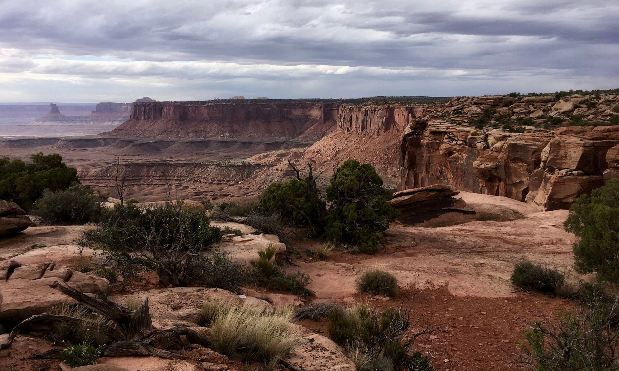
As well as impressive mountain and glacier views before us, the view behind when we stop for a breather is equally superb. The long Ville des Glaciers, flanked by high mountains funnels down to Les Chapeiux. The sun is now out and there are fluffy clouds, blue sky and a sharp clarity to the air.

One of the big attractions of the TMB and one that makes it so popular is you get to walk through three different countries, France, Italy and Switzerland, crossing into each of them over high and remote mountain passes.

And the Col de Seigne is our first international border. Having reached the top of the pass, in one step I cross from France into Italy without a border guard to be seen. To our European friends of course this is no big deal, they can move freely between twenty six countries. Steve was way ahead of me and by the time I arrive he’s set himself up on a little spot, food and drink in hand looking down the long Val Veny valley into Italy.

There is still plenty of snow on the Col despite it being mid July and there is a large patch right in front of us on the north facing slope. Snow covers these high passes for much of the year so it’s only really between mid June to mid September that they become accessible for walkers without the use of ice axe and crampons. It’s a short walking season.

After getting my breath back I have a good look around. At 2516m (8,254ft) this is not only the high point of the day but the highest we have been so far on the walk. The col itself is a wide plateau with a small stone pillar with directions on the flat area and a larger pillar at the highest point of the col. Next to the pillar is a circular toposcope showing the mountains on the Italian side. All around are stunning mountain scapes and a sense of grandeur.

We are now heading around to the southern, Italian side of the Mont Blanc massif which has a sharper more rugged look than the French side. In the foreground the twin peaks of Les Pyramides Calcaires rise dramatically up from the valley floor. Beyond is petit Mont Blanc and beyond that, in the clouds, Mont Blanc itself.

The way ahead lies down Val Veny which we will follow all the way to Rifugio Elisabetta. It’s a steep drop off the col with some stony ground and a couple of snow patches to negotiate. The steepness is short lived however and we are soon at the well built and maintained Casermetta de Col de La Seigne. It’s an odd location for such a sturdy building. It has no water or other facilities and eating food in or around the building is discouraged but it does have a good balcony with seats and a viewing platform over the valley. It turns out to be a museum dedicated to protecting the natural and environmental heritage of the Mont Blanc area and when we go inside it has a number of displays on show.

From the Casermetta there is a short descent but soon we are enjoying easy walking along the valley floor all the way to Rifugio Elisabetta. The Rifugio is positioned high up on the valley side so it’s a short, heart pumping final little climb at the end of the day to reach it.

Rifugio Elisabetta is one of those iconic mountain huts I have mentioned and I am particularly looking forward to staying here. Sitting in the sunshine on its new looking balcony/veranda it’s easy to understand why it’s so revered. Set high off the valley floor it is it’s own mountain eyrie giving you a high vantage point to observe all around you. And the views are quite simply magnificent. The opposite side of the valley rises up to Mont Perce and Mont Fortin. The wide Val Veny valley, which we will follow tomorrow can be seen for miles stretching down towards Courmayeur, and beyond is the Mont Grande Rochere range of mountains.
At the back of the Rifugio the ground rises steeply all the way to the summit of Aiguille des Glaciers. More glaciers are seen, Glacier des Echellettes and the larger, impressive Glacier de la Lex Blanche which is a convergence of three glaciers into one huge one coming down from Aiguilles de Tre La Tete and Petit Mont Blanc. Meltwater is pouring out of its base, cascading down the valley in great waterfalls that can be heard from the lodge.

At dinner we sit and chat with three fellow boomers from the golden state of California. Because I booked early we managed to avoid the large and unappealing bunk rooms of maybe thirty beds and we are in with Kyle and Jo again in a three bunk, six bed room with only the four of us in it.


Before bed I sit on the veranda and watch the light of the unseen setting sun change the appearance of the landscape. The soft, low light casting into the valley turns water into silver strands and rocks the colour of honey, highlighting every contour and grain with a shadow. I go to bed thankful that such beautiful places exist and that I am able to visit them.
To Read More About My Hike Along The TMB Click Here
Route Map, Walk Stats, Geolocated Picture Gallery and 3D Flyover Video Below.
Click ‘Learn more’ on the map. Note: you won’t see the map if reading in WordPress reader but click on the little world at the top of the page to view it on the browser.
Just wow 🙂
Thanks Ruth, the scenery was pretty special 🏔️
It’s truly beautiful, isn’t it? I would have been thrilled just with the ride up.
Thanks Jo, it really is, so glad I finally got to do this walk
Grateful you shared you experiences with us, such beautiful places. It looks like the trails are quite difficult, still they are so busy if you had to book everything 8 months in advance.. But the scenery is fantastic, so well worth it!!
My pleasure Christie, that’s why I blog. If you are used to walking in the mountains the trail is not so bad and yes it is popular so needs to be booked well in advance, unless you are camping of course.