

It’s the Queens Platinum Jubilee Weekend and Seventy years of Her Majesty on the Throne is being marked by street parties up and down the land and a double Bank Holiday. Even the weather is paying homage with warmth and sunshine. Not one for street parties, or pomp and circumstance I have managed to squeeze into Gillside campsite in Glenridding, the perfect starting point to climb the remaining two hills of Book One, Birkhouse Moor and Catstyecam and bring my journey through Book One, The Eastern Fells Fells to its conclusion.

I set off a little early as I know it’s going to be a busy day on the hill and it’s a nice steady walk up Little Cove. Looking behind me regularly (as you must always do in the hills to avoid missing the view!) I can see Glenridding getting smaller and the flat calm pale blue of Ullswater Lake getting longer as it stretches out towards Pooley Bridge.

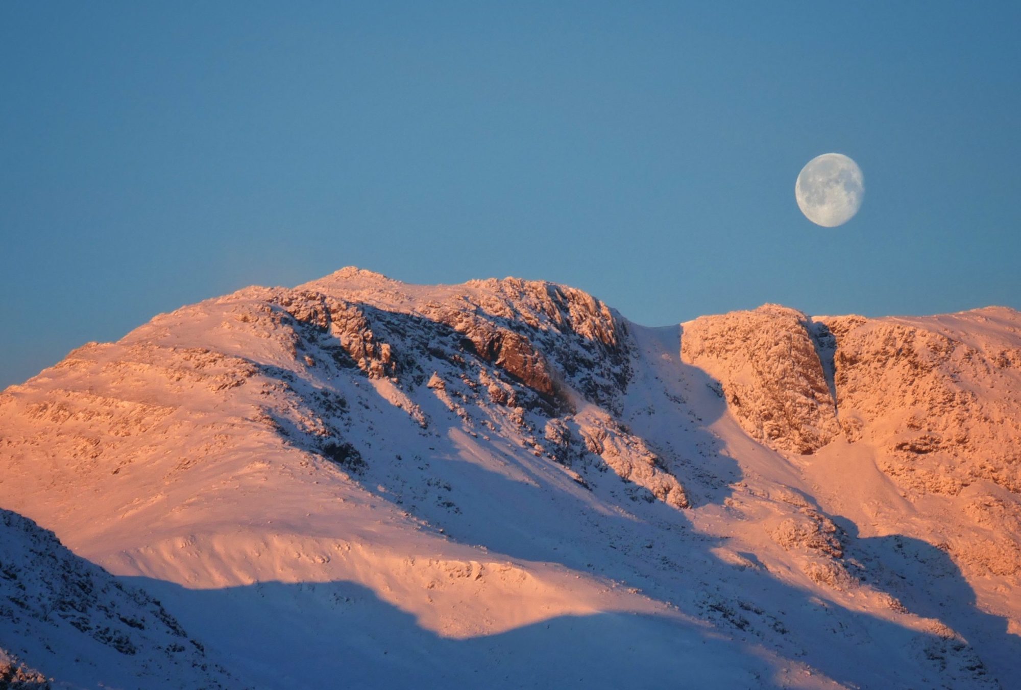
It was 2018 when I last passed this way and I see that the path heading straight to Hole in the Wall has been blocked off for repairs. This suits me as the alternative path is the one that leads to my first summit. This path to Birkhouse Moor climbs up to a nice little shoulder which provides a great viewpoint down to Glenridding and Ullswater.

After a short distance a feint path on the right, easily missed along the broad highway is reached. Although the summit is not seen from the path, I follow it upwards and after about a hundred metres or so I am standing on the the flat grassy top of Birkhouse Moor.

Birkhouse Moor is one of those summits, like Dollywaggon and Nethermost Pikes that are often bypassed by those blazing along a broad path with their sights set on a bigger prize, Helvellyn being the prize in all these examples. This is a shame as Birkhouse Moor, in my opinion provides a grandstand 360° view of the the Helvellyn Horseshoe that is well worth the extra hundred metres to see.
In one direction Helvellyn, it’s ridges and Catstyecam stand proud on the skyline. In the other, Ullswater and the Far Eastern fells spread out in a panorama on the horizon. It’s also a rather pretty top, a bit like Birks, soft luscious grass underfoot with a small understated cairn marking its summit. Leaving Birkhouse Moor the main path is rejoined and followed to Hole in the Wall where another classic view of Helvellyn is observed.

Having walked over Striding Edge a few years ago and Helvellyn summit some months ago I decide to forego it’s pleasures and head down to the shores of Red Tarn. At the tarn there is a little community of about six tents pitched by the shore. There has been a lot of talk in the walking media recently about fly campers and some of the pictures I have seen of abandoned cheap tents, camping chairs and rubbish have been quite disturbing.

The guys here don’t seem to be fly campers though, the gear is quality kit and there is no rubbish to be seen. Also you have to put a bit of work in to get here and I sense fly campers prefer the shores of the lakes and don’t like sweating too much.

From Red tarn I start the steady climb up to my final summit of the Eastern Fells, Catstyecam. Helvellyn was the first high summit I ever climbed in the Lake District, in the mist, forty years ago, and for decades I imagined that Catstyecam might be my last if I ever got round to doing the Wainwrights. Deciding to do them book by book has obviously ruled that idea out. I do know what my final summit will be when I eventually get round to Book Seven but that will remain my secret for now.

Essentially it’s a Zig and a Zag from Red tarn up to Catstyecam. The Zig leads up from the tarn to join the path coming down from Swirral edge at the col. The Zag then joins the connecting path from Helvellyn at the bottom of Swirral edge and follows it up the defined and narrowing ridge straight to the summit. A summit more different to Helvellyn but so close to it could not be imagined. Helvellyn is broad, wide and flat, you could land an Aeroplane on it, and indeed somebody has.

Catstyecam however is a mountaineers summit, as Wainwright describes “nearly, but not quite the perfect mountain form, with true simplicity in its soaring lines and a small pointed top, a real summit that falls away sharply on all sides”. That top is perhaps fifteen metres or so square and you get a real sense that you have scaled a mountain when you reach it.
Its conical shape also means that there are great views all around although the view to the South West is dominated by Helvellyn, it’s closer and higher neighbour. I sit for a while on the summit as people come and go, enjoying the clear views and contemplating my achievement. I do have a sense of satisfaction in completing my journey through Book One but there is a long way to go and I find myself already looking over Ullswater towards the Far Eastern Fells, the subject of Book Two.

I am glad that I decided to walk the Wainwrights Book by Book. I have particularly enjoyed the intimacy of walking the same area, sometimes along the same paths, becoming familiar with the immediate landscape and its summits, valleys and lakes. I have enjoyed seeing how the seasons change the look and feel of the terrain and the satisfaction of seeing mountains that I had walked upon only weeks or months previously from a different perspective.
From Catstyecam I drop steeply down the South East ridge which joins the main path below Red Tarn and enjoy the walk down Glenridding Common in the afternoon sunshine. As I reach the bridge crossing Glenridding Beck I pause for a while listening to the rushing waters and take a look back at the pointy summit of Catstyecam, rising up into the sky.

I shall certainly miss the Eastern Fells but I’m looking forward to starting a new relationship, The Far Eastern Fells are calling.
To Find All My Walks In The Eastern Fells Click Here
For a map, route details and picture gallery of this walk please click ‘Learn more’ below.