

The cloud is hanging low in the valleys as I leave the campsite. It is one of those still, silent Lakeland mornings where even the sheep are silenced by the muffling effect of the mist. Driving past Thirlmere, the water resembles a sheet of glass, the evergreens on the hillside reflecting perfectly in the Mill Pond flatness of the reservoir.
Today’s walk starts from a lay by just North of the footpath that leads up Tongue Gill on the outskirts of Grasmere. Once on the footpath Seat Sandal, today’s objective can be seen straight ahead, rising up to the heights on a whale back ridge. I have walked up the Tongue Gill valley path many times so by way of variation I will be taking the path to the left of Tongue Gill to Grisedale Hause and then taking ‘route one’ to the summit returning via that long whale back ridge so I have good views of Grasmere and beyond on the way down.


The forecast is for rain this afternoon but this morning all is fine and as I get into my rhythm the clouds are clearing from the valley, removing any hope of a cloud inversion. The path is well defined all the way to the bottom of Great Tongue where Tongue Gill and Little Tongue Gill meet. There are two bridges here and the sound of rushing water is loud in the ears. The path to the left of Great Tongue crosses the first bridge but heads off left before the second bridge and is not that easy to make out if attention is wandering.


The path now turns to grass, perhaps an indicator of how little this route is used compared to the main one up the valley and continues following Little Tongue Gill up towards the rocky outcrop of Hause Riggs which is seen up ahead. As I walk upwards the sun comes out and lights up the dew on the grass in front of me. Its like a million tiny diamonds have suddenly appeared under my feet.


The path climbs up and over the outcrop and it is worth pausing here to admire the view back down the valley towards Grasmere. Once over Hause Riggs the path flattens and traverses the hillside joining the valley path just upstream of the large waterfall that has no name but is marked on the OS map.

At Grisedale Hause I take a break and sit and admire Grisedale Tarn, sitting in its little bowl amongst the mountains. To my left I can see the way ahead which to be honest doesn’t look too inviting. A scar of scree and rocks climbs steeply up the hill for a couple of hundred feet before easing off. I think the best thing to do on a path like this is just to grind it out, switch into crawler mode and keep moving until things improve. That could also be a metaphor for the troubles of life.


At the top of the badly worn bit the incline eases and the path rejoins the wall which has also risen up from Grisedale Hause but has broken up on the steeper lower slopes. From here the wall is followed all the way to the summit.

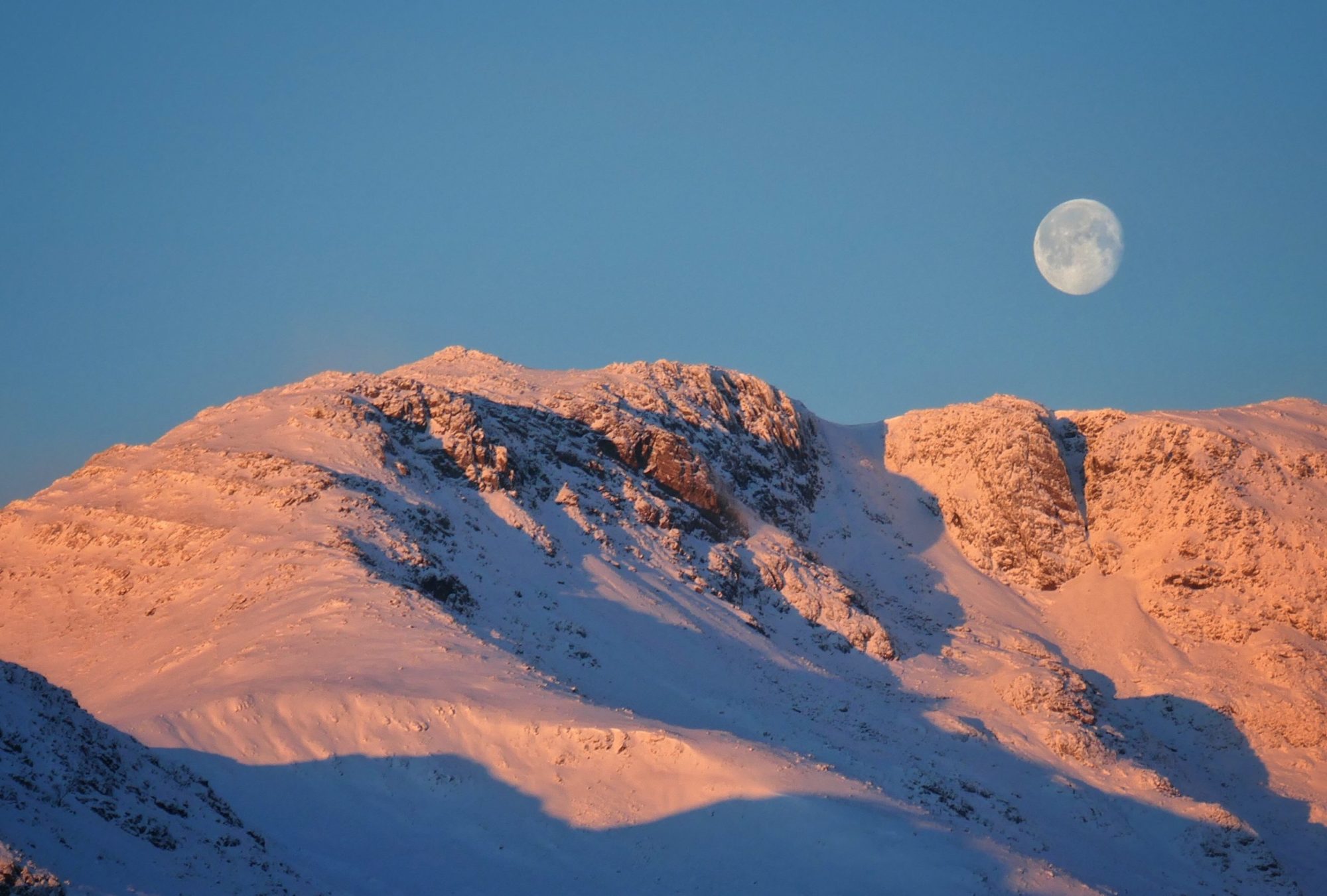
I arrive at the summit just as mist is threatening to envelop the scenery in its blanket of grayness so I waste no time in getting the camera out. Thankfully, although the mist blocks the view West it stays off the summit and I get to admire the view down to Grasmere. The lake, the village and the patchwork of green fields spreading out along the broad valley bottom are alternately in darkness and light as the sunshine breaks regularly through the clouds. Beyond, Windermere, Esthwaite and Coniston Water are also seen from the summit, looking like someone has taken a blue highlighter and made three blue lines on a green piece of paper. Even further beyond, Morecambe Bay and the Irish sea stretches to the horizon.

Looking East, I can also see Ullswater all the way down the Grisedale valley as the cloud floats around the summits of Dollywaggon Pike and St Sunday Crag. Four lakes and an ocean for the price of one hill, I’ll take that.

Setting off West I reach the cairn that marks the top of the ridge and can see that although lower than the summit cairn it is actually a far better viewpoint for Grasmere. The ridge itself provides a good route down, not too steep on a good path and as I had hoped gives good views ahead all the way back down to where it joins the main path at a gate and a stone barn.


Walking back to the van I am grateful that the rain and the mist held off and I got to enjoy another cloud free summit in beautiful Lakeland.
To Find All My Walks In The Eastern Fells Click Here
For map, route details and picture gallery of this walk click on ‘Learn more’ below