

My last visit to Ullscarf was thwarted when the clouds which had been hovering above it all day decided to lower onto the summit plateau just as I reached it. As I have a rule that I will be able to see the view from each top on my journey through the Wainwright’s this unfortunately meant a return visit. At least going up again gives me a chance to try a different route and today I’ll be ascending via Harrop Tarn and returning down the Wythburn valley which means I don’t have to walk back on myself.

I park the van at Steel End car park as it’s closer to my finish point and set off up the reservoir road to the car park at Dob Gill. It’s a beautiful late summer, early autumn day, cool but not cold and the sun is shining through the tall straight pines that line the road. Thirlmere itself remains unseen, hiding behind the greenery.


Before long I have crossed Dob Gill Bridge, walked through the car park and a gate takes me onto the footpath heading up through the forest on a rocky but pleasantly graded path. The musty aroma of pine and woodland starts to fill my nostrils and the silence of the forest closes in around me as I get into a rhythm.


Sunlight strobes through the branches and the crunching of my boots and the sprightly Dob Gill are the only sounds. In what seems like no time at all I reach Harrop Tarn. I’ve been here once before and on that occasion bumped into a middle aged couple, completely naked heading into the tarn for a swim.


From the tarn I follow a forest road for a short while until a bridleway is joined and I’m in the trees again. The path climbs steadily through the woods and ends abruptly at a gate by an old stone ruin. Beyond is the open fellside which in this part of the lakes is more like moor than fell.

Once in the open any idea of following a path is soon abandoned. The terrain is such, an expanse of boggy, angled, knee high bracken that all tracks vanish and I employ the tactic of picking a point ahead in the general direction I’m heading and walking to it making sure I’m not veering off course or losing height.

After some boggy bracken bashing I pick up the fence which leads to a gate, beyond which the path up Standing Crag is more clearly defined heading nicely up through a gap to the left of the main crag. The path looks steeper than it actually is and looking back there are good views of Blea Tarn and the Newland Fells with a little glimpse of Derwentwater.

Once through the gap there is a bit more effort required before the wide boggy plateau/ridge of Ullscarf is reached. This takes me, one squelchy heathery tussock at a time up to the summit cairn.

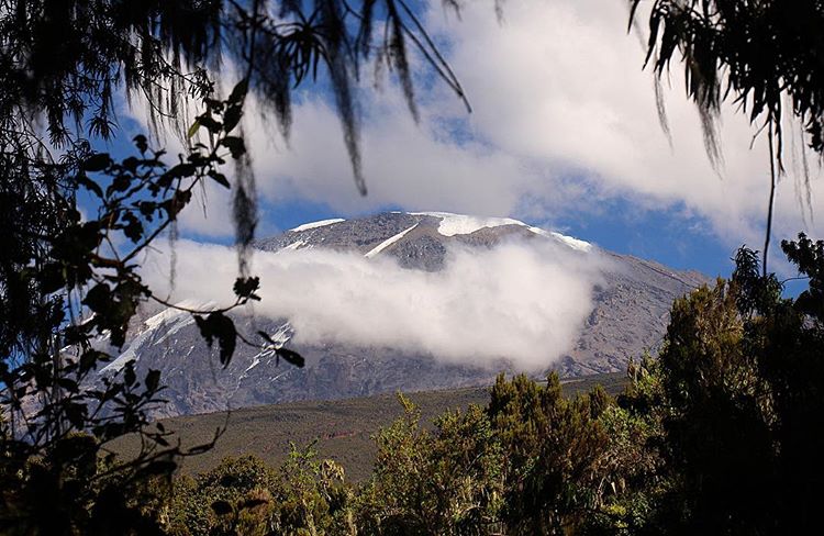
I almost convinced myself last time I was here, after expending the effort that the view was good enough, I could just make out Windermere after all. Looking around me at the view now, the one denied to me then, I am satisfied in my resolve that I need to see from these mountains in order to experience them fully. Honister Crag looks like someone’s taken a slice out of it, the cathedral looking dome of Great Gable looks majestic, as it always does and the ‘end’ of Great End leads the eye nicely along the high ground to the mighty Scafells rising up behind it.
A guy comes up behind me who had been ahead of me in the woods but had obviously wandered a bit in the mire and two others arrive and depart. These will be the only three people I see all day. After eating and drinking I leave the summit on my chosen route back.

The path to Greenup is uneventful but my troubles begin when entering Wythburn. I had a route marked but either missed it or more likely it just wasn’t there. Either way it’s a downhill trudge across pathless boggy ground where I pick up a feint path along Flour Gill.

From above I had spied a couple of tracks leading across an unavoidable section of flat marshland but trying to find them on the ground once again proved fruitless so I end up squelching through knee high sodden bracken to pick up the gill again further down the valley.

Arriving at a sheepfold I think the worse is over but a little further on I realise I’m on the wrong side of the now burgeoning Wyth Burn and will have to cross it to avoid a marsh known as ‘The Bog’. Crossing rivers in mountains is not recommended, there is a lot that can go wrong and in remote areas, exposed to the elements, with no signal, the consequences of a fall can be serious. I also carry with me a memory of a bad slip once whilst crossing a river and was fortunate to walk away with a complete soaking and badly bruised hip as opposed to a fractured skull and a helicopter to hospital.

So it is with trepidation that I look at the fifteen feet of reasonably deep water and wet slippy rocks that separate me from the path on the other bank. At least it wasn’t fast flowing. Having located a spot that offered me the best chance of success, first and foremost without slipping and secondly with a chance of not making my feet any wetter than they were, using my poles and making sure of my footing I get across without incident.

The path clings to the side of the high ground as the morass of The Bog is passed and the valley then starts to narrow and steepen as the crags of Wythburn Fell rise up on either side. The path, pretty rough in places passes Castle Crag and traverses underneath Black Crag. A small consolation is the abundance of waterfalls on what is now a fast flowing Wyth Burn as it tumbles down the valley.

When I finally reach the footbridge that I have seen on the map I think once again that the hard work is over and I’ll enjoy easy going with a stroll back to the car park. Alas today was not going to be one of those days. Of the two footpaths, one each side of the river I choose the one that follows the north bank. At first all is well but soon I am waist height in bracken on a rocky slope.

Looking at the south bank path I can see it has led into the intake fields and is certainly better walking than the path I’m on. What to do? I really don’t fancy retracing my steps up to the bridge so for the second time in one walk I have to cross over the river. By now I’m in no mood to mess around and as I’m nearing the end and off the high ground I decide to walk across on the river bed using my poles to steady me, water up to my knees. My feet were wet anyway and walking in the river minimises the risk of slipping on rocks which was my main worry after a frustrating and tiring walk down the valley.

A few fields later I’m back at the van, stripped off and in dry clothes. Wainwright describes the Wythburn valley as ‘remarkable’ but also acknowledges that it is wet, pathless and a ‘study in desolation’ which indeed it is. Wythburn is not a valley I will be rushing back to, but I have seen the view from Ullscarf and that is enough.
To Find All My Walks In The Central Fells Click Here
Route Map, Walk Stats, Geolocated Pictures and 3D Flyover Video Below.
Click ‘Learn more’ on the map. Note: you won’t see this if reading in WordPress reader but click on the little world at the top of the page to view it on the browser.
Well done for getting over the burn!
Thanks Tricia, a lot of its in the mind if you’ve had a bad experience before, like a lot of things I think
I think I like to know where I’m going and with a well marked path. So well done on this one!
Thanks Shazza, I don’t mind a bit of off path walking but it comes with its own challenges! and this one seemed to have more than most 😀
I’m not at all inclined to follow you on this one, Jim. I feel bone weary just thinking about it, but I’m glad you made it.
Thanks Jo, yes Wythburn was a bit wearisome and I was glad to get to the bottom of it, sometimes you have to take the rough with the smooth as they say 😀
The landscape is stunning and so are the views. I’ve had my fair share of moments where I had to cross pathless boggy grounds due to missed or nonexistent signs, it’s not something I’d like to experience again as it demands more effort, and drains your energy faster. Thanks for sharing, and have a good day 🙂 Aiva xx
Thank you Aiva, yes it certainly hard work when there’s no path😀 xx
🥰🥰
What a lovely mix of different footpaths and views!
Thanks EJ 😀
An enjoyable read, Jim. By coincidence I was on Ullscarf last Friday morning, in the clouds unfortunately, so nice to see the panoramic view!
I descended the Wythburn valley in March this year, in absolutely sodden conditions, and I found the going slightly easier in the upper part of the valley if I stuck to the base of the steep ground to the north, above the moss. I had to cross the river too, relatively easy a short distance downstream from the sheepfolds, despite rain in the night.
Thanks Richard, 😀 yes I think that’s where the open street map path is shown but I completely missed it. I think rivers make me nervous having fallen in one
I’m loving natures paintbrush in your photos.
Thank you Lisa 😀
Looks like they are great summit but need to find another way to do them. I hate when there is no path or need to cross river. Hopefully next walk you do will be easier.b
Thanks Mél, it was 😀
I’m not a fan of river crossings either. I think Ullscarf and the area around it is a bog fest whichever way you do it, but your descent route sounded a right pain.
Thanks Tessa, it certainly is and I’m not in a hurry to visit Wythburn again!